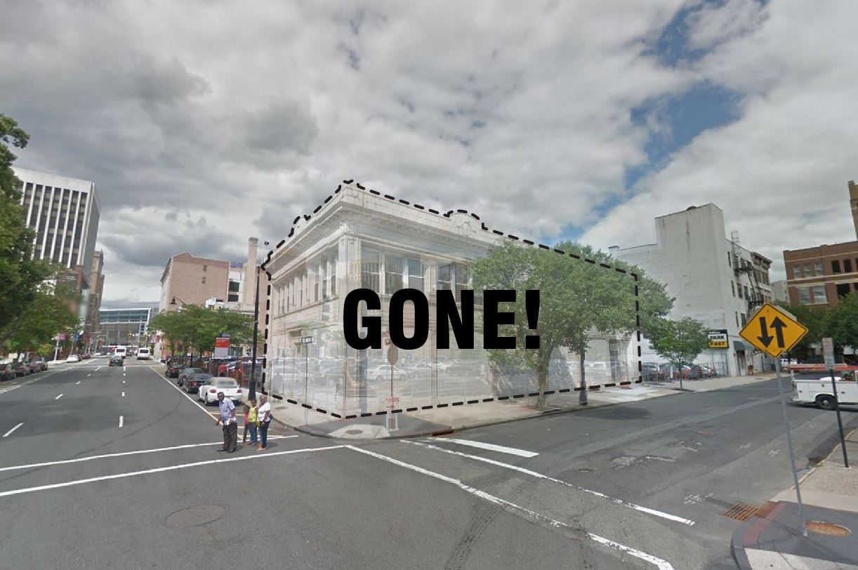
20-26 Bruen Street
2014
Application Reference: ZBA 7-14-C
The proposal for a surface parking lot on Bruen Street brought the community together to form PLANewark (under a different name at the time) and has driven much of our work since. The area around Penn Station has long been dominated by commuter parking lots and has been steadily growing for decades. In 2014, members of the neighborhood opposed the creation of yet another parking lot on a property where a building had to be demolished to make way. Expert testimony was given against the lot, and the Zoning Board decided the negative impacts vastly outweighed the positive contribution the lot would have had in the neighborhood. This represented the first time citizens of Newark successfully opposed the creation of a parking lot. PLANewark members advocated in favor of dense, mixed-use development and won.
Click here to learn more about this project.
Washington Street Lot
2015-Present
Application Reference: ZBA 15-66
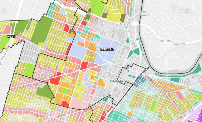
Edison Properties owns and operates a large parking lot at the corner of Washington Street and Central Ave in the heart of downtown Newark. In the summer of 2015, the company proposed an expansion of that lot to take the place of a former terracotta building with contributing historic character. PLANewark opposed this action because surface parking lots are not permitted anywhere downtown and because of the loss of character in the James Street Historic Commons. Instead of a long battle with Edison, we forged an agreement with two important outcomes:
- Edison agreed to vast improvements to the original design including planted buffers around the perimeter, less obtrusive signage, bicycle parking stands, electric car charging stations, and more. These non-standard features have helped to improve the visual appearance of the lot and contribute some small public benefits.
- Edison agreed to enter a development process in which several options will be evaluated to redevelop the lot with a large, mixed-use building. If at the end of this process, redevelopment is financially feasible, PLANewark will be advocating for the kind of development that will bring tangible public benefits to the neighborhood.
Click here to read the development agreement between Edison Properties and PLANewark.
Central Avenue Lot
2015-2016
Application Reference: ZBA 15-65
Similar to the Washington Street Lot, PLANewark entered an agreement with Edison Properties in order to bring public benefits into the plans for a surface parking lot expansion. This expansion also was taking the place of an existing building which was demolished under questionable circumstances. We were not able to win a redevelopment agreement for this lot, but we were able to secure several improvements that contribute to the neighborhood including planted buffers around the perimeter, less obtrusive signage, bicycle parking stands, electric car charging stations, and more.
Click here to read the agreement between PLANewark and Edison Properties.
Family Dollar
2015-2016
Application Reference: CPB 15-38, CPB 16-03
Members of PLANewark worked with the Broad Street Neighborhood Association (BSNA) and others to protest the development of a suburban-style Family Dollar store in the Lower Broadway neighborhood of Newark. When the application was heard by the Central Planning Board, residents used their knowledge of the application, the Newark Master Plan, and the recently adopted zoning regulations (NZLUR) to present arguments against the development. Based on the persistence of BSNA and some technical assistance from PLANewark, the applicant was denied twice by the Planning Board. While this does stall development on the lot in the short term, it does retain the possibility that the Master Plan will be fully realized along this main artery of Lower Broadway. The neighborhood group and the owner of the property have already begun talks to transform the vacant lot and small garage into mixed-use development that will benefit everyone.
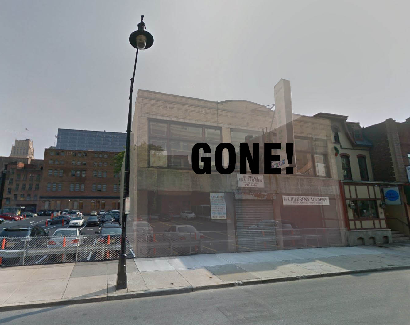
28-50 McWhorter Street
2013-Present
Application Reference: ZBA 16-73, ZBA 17-26, CPB 18-15
J&L Parking Lots has slowly amassed dozens of acres of surface parking lots in downtown Newark. Although the company has started to develop some of their lots, it is only the ones furthest away from the heart of the neighborhood that are getting attention. Starting in 2013 and continuing to this day, we have fought against this parking lot between the Ironbound neighborhood and Penn Station which has stifled development in the area. Members of PLANewark appealed the original Zoning Board approval and won at the State of New Jersey Supreme Court of Appeals. Now, the company operates the parking lot illegally.
Taco Bell
2017-2018
Application Reference: ZBA 16-61, CPB 17-21
Residents of the Lower Broadway Neighborhood Association and the Historic 8th Avenue Association reached out to PLANewark about an application for a standalone drive-thru restaurant at the “gateway” between Downtown and Lower Broadway. PLANewark and local residents presented arguments against the project which is inconsistent with the Broad Street Station Redevelopment Plan and exacerbates the problems with fast-food and auto-oriented businesses within a transit-rich, residential neighborhood. In January 2017, the Zoning Board of Adjustment denied the application. However, Muy Brands re-applied and was granted approval from the Central Planning Board in July of 2017, despite the application being almost identical. The Taco Bell completed construction in 2018 and will remain for some time as a reminder of the deficiencies in the planning and development process.
Newark Guide to Planning for Residents
2019
PLANewark is working on a booklet entitled “Newark: A conversation on change in our city.” This booklet is meant to be an introduction to planning and development issues in our city and explain what these issues mean for everyday life. Presented as a series of questions and answers, this booklet provides a pathway to learning about and participating in the planning process that is accessible to all Newark residents.
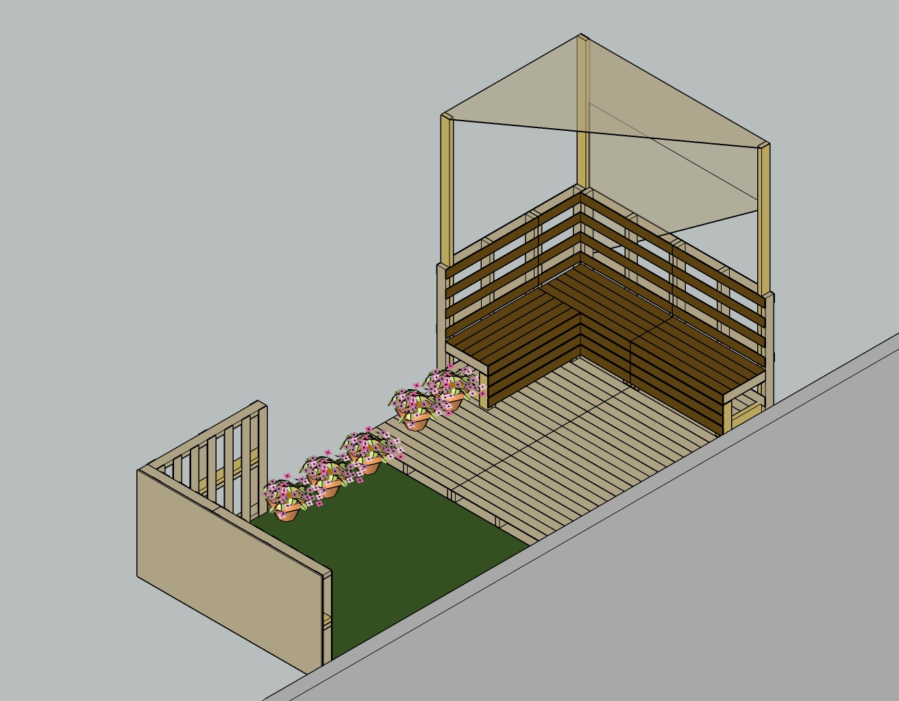
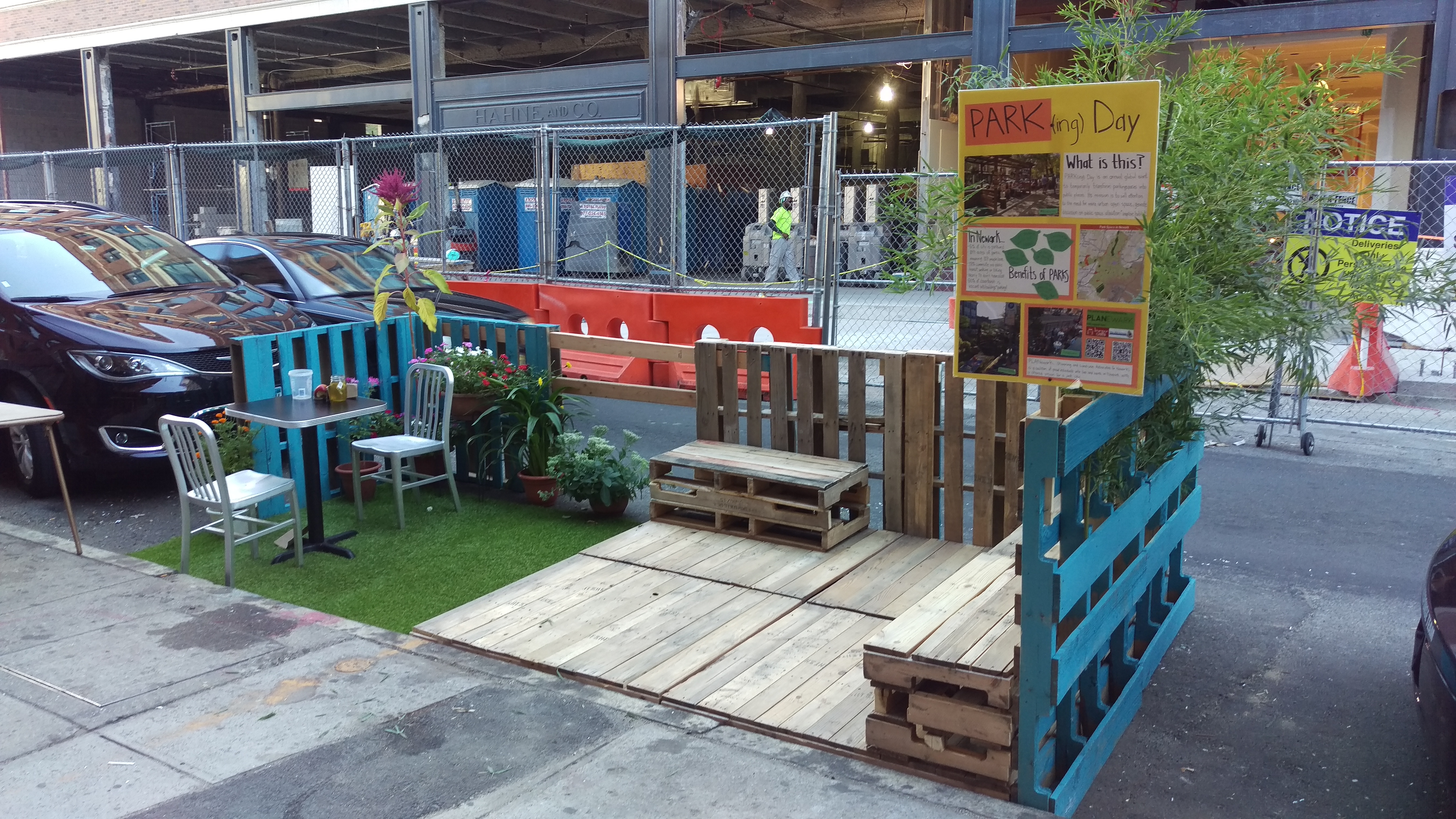
Parking Day
2015-Present
PARK(ing) Day is an annual worldwide event that takes place on the third Friday of September where artists, designers and citizens transform parking spots into temporary public parks. In 2016, PLANewark participated in this event by occupying parking spot with a pop-up public parklet on Newark’s Halsey Street shopping corridor.
To learn more about what PARK(ing) Day is, click here.


Old Essex County Jail Project
2019
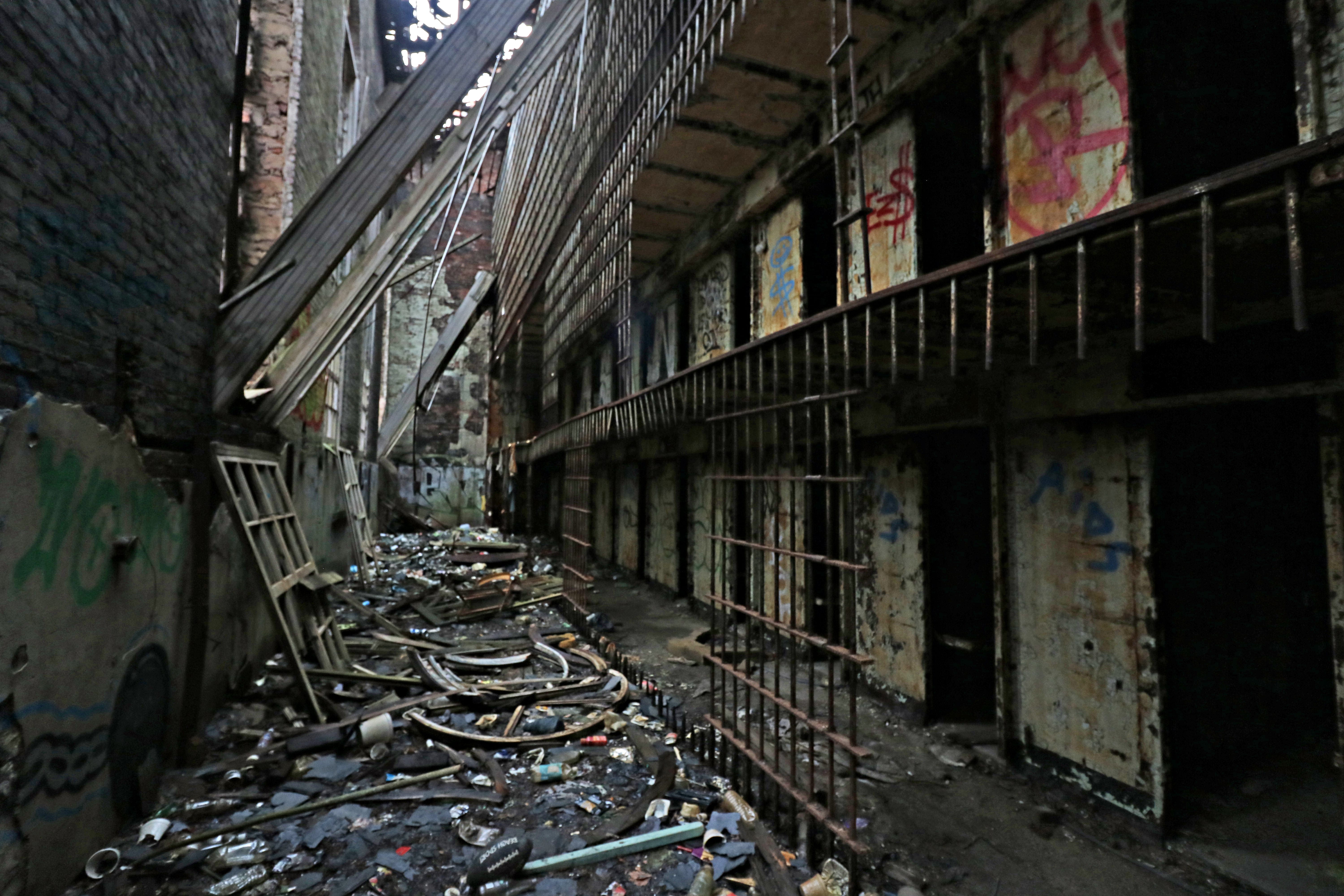
PLANewark is a proud sponsor of an exhibit on the old Essex County Jail. In part, this project documents and displays the work of Columbia GSAPP students from 2018. A website has been created to display the history, current state, and future reuse proposals for this historic site.