
Newark’s Master Plan
Current Master Plan published in 2012. This Master Plan serves as the underlying principles of the current Newark Zoning and Land Use Regulations (NZLUR). Any changes to NZLUR must be consistent with Newark’s Master Plan.
| Volume 1 | Volume 2 | Mobility Element |
Newark Zoning and Land Use Regulations (NZLUR)
Current zoning regulations adopted in March of 2015 that govern land use, building bulk, parking, design guidelines, and the overall form of our city. Any development application that deviates from these regulations requires a variance from the Central Planning Board (CPB) or Zoning Board of Adjustment (ZBA). The interactive zoning map below allows users to zoom into particular properties to check the zone designation.
| NZLUR* | Zoning Map (beta) | NZLUR Summary |
*The Newark Zoning and Land Use Regulations have been amended to include the following. Any amendments supersede language in NZLUR.
| Inclusionary Zoning Ordinance (IZO)
In general, the IZO requires medium to large residential developments to set aside at least 20% of apartments to be “affordable” as defined by the State of New Jersey. These rules apply to new developments over 30 units or rehabilitated developments over 40 units under the following situations: developments seeking ‘C’ or ‘D’ variances from NZLUR or a Redevelopment Plan; all developments sold by the City of Newark through a redevelopment agreement; and all developments in an MX-3 zone (defined below); |
| MX-3
This ordinance created a new zone in the Ironbound neighborhood next to Penn Station. In addition, it introduced new uses and modified bulk requirements in all zones throughout the City. The MX-3 ordinance was adopted despite being inconsistent with Newark’s Master Plan. The New Jersey Municipal Land Use Law requires that the municipality state official reasons why the ordinance was adopted with the inconsistencies. Read here for the official response. |
| Zoning Board Application Fees
To help increase the processing speed of applications, the city revised the rules for the Zoning Board to assess fees on applications. Presumably, this revenue will be used to hire more planning staff to handle applications. |
| Zoning Board Meetings and Stipend
This permits the ZBA to meet up to 40 times per year, allows 2 additional alternate board members, and provides a $5000 stipend per year for each member. |
Interactive Zoning Map
This map provided for reference only. See the NZLUR for the official map.
Newark Redevelopment Plans
In particular areas throughout Newark, redevelopment plans overrule the NZLUR and govern the land-use, building bulk, and other regulations. In general, these plans are applicable throughout Downtown, the Kent/Brenner/Springfield neighborhood, and the Riverfront.
Office of Planning and Zoning
The website for Newark’s Office of Planning and Zoning includes links to the Master Plan, NZLUR, the CPB, the ZBA, the Landmarks and Historic Preservation Commission, as well as many other links and resources to learn about planning and development in Newark.
Organizations and Authorities
Below is a list of planning and development organizations and governmental institutions that set policy on planning and land-use issues in our area.
| North Jersey Transportation Planning Authority | The NJTPA is the federally authorized Metropolitan Planning Organization for the 13-county northern New Jersey region. Each year, they oversee funding for transportation improvement projects and “provide a forum for interagency cooperation and public input.” |
| Regional Plan Association | The RPA is an urban research and advocacy organization. RPA works to “improve the prosperity, infrastructure, sustainability and quality of life of the New York-New Jersey-Connecticut metropolitan region.” |
Interactive Parking Map
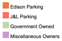
Explore an interactive map of the 300+ acres of parking in Downtown Newark. This map is part of PLANewark’s ongoing fight against the expansion of surface parking in Newark. Click the rectangle icon on upper right hand corner of map to view full screen. Click on individual, color-coded lots to view information on the property owner and acreage.
